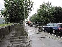
Oxpens Road
Road in Oxford, EnglandOxpens Road is a road in central Oxford, England, linking west and south Oxford. It is named after the marshy area of Oxpens, next to one of the branches of the River Thames in Oxford. It forms part of the A420 road.
Read article
Top Questions
AI generatedMore questions
Nearby Places

Oxford Ice Rink
Ice arena in Oxford, United Kingdom

Osney Cemetery
Cemetery in Oxford, England

Morrell's Brewing Company
Brewery in Oxford, England

St Thomas' Street, Oxford
Street in central Oxford, England
Paradise Street, Oxford
Street in central Oxford, England

Swan Bridge
Grade II listed bridge in Oxford, English

City of Oxford College
Further education college in Oxford, Oxfordshire, England

Activate Learning
Educational services provider school in Oxford, Oxfordshire, England


